If you’ve never driven to Glady, West Virginia, you will be welcomed with beautiful farms and rolling hills. It is a pretty drive on any given day especially a spring day. There are many designated signs for the West Fork Rail Trail so you shouldn’t have any problem finding the parking lot, just continue on the road until it turns into gravel and park at the gate. You can also find, on this little stretch of the road, a historic Presbyterian church and parsonage that was built in 1905 that’s listed on the National Register of Historic Places.
At the parking lot as you unload your bike or start gearing up for your hike, you’ll more than likely be greeted by 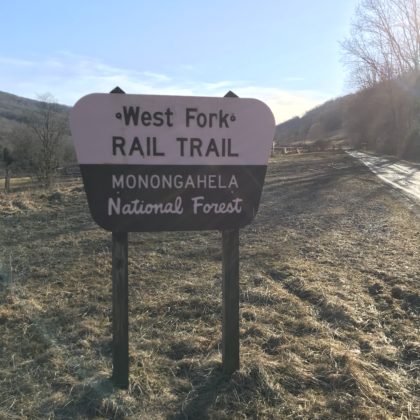 the cows and sheep. Depending on the time of year, you might even see some cute baby lambs and calves. We suggest starting in the morning for this adventure so you’ll be back to your vehicle by evening. Forewarning expect a moderately strenuous 12.6 mile round trek.
Leaving the parking lot on the rail trail, I decided to bike this portion of the adventure which wasn’t necessarily a bad thing but it became a hassle later once I reached the trailhead to the High Falls of Cheat. The first part is around a 3-mile slight descent on loose dirt and pebble like gravel like you would normally experience on a rail trail. Be on the lookout for a small upright post on the right hand side which signifies the trailhead to the High Falls of Cheat. This portion of the West Fork Rail Trail also intersects with another High Falls of Cheat Trail that takes you to another parking lot. This is where I ditched my bike because no matter what the internet tells you this is not a biking trail, but hey at least it took me less time to get to the trailhead from my vehicle. The High Falls Trail leads you into the forest and can be overgrown at times. The US Forest Service maintains the trail seasonally and on the day of my adventure, they were working not only on the beginning muddy part of the rail trail, but also on the High Falls Trail so it wasn’t as overgrown as it normally can be. Switchback after switchback, up the mountain, make up this part of the adventure, with about 800 feet of elevation gain.
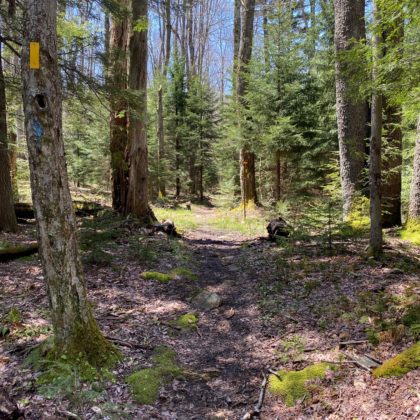 At the top of the ascent, a large shaded campsite awaits for those wanting to backcountry camp. At this point, the Allegheny Trail merges with the High Falls Trail dressing the trees with yellow and blue trail markers. The yellow is for the Allegheny Trail and the blue is for the High Falls Trail. In my opinion this was the prettiest sections of the trail. The moss-covered rocks and looming giant spruce trees captivate your attention.
Now comes the semi-easy part of the journey as you begin your hike down the other side of Shavers Mountain. It is still a steep decline and full of more switchbacks. Make sure to “pick your feet up and look ahead” as to not trip or stumble on any roots or rocks. Downhill is one of the easiest ways to hurt yourself because your body starts to relax. About halfway down the trail, you’ll start to hear the sound of the roaring river below. It’s about 2.5 miles to go up and over the mountain.
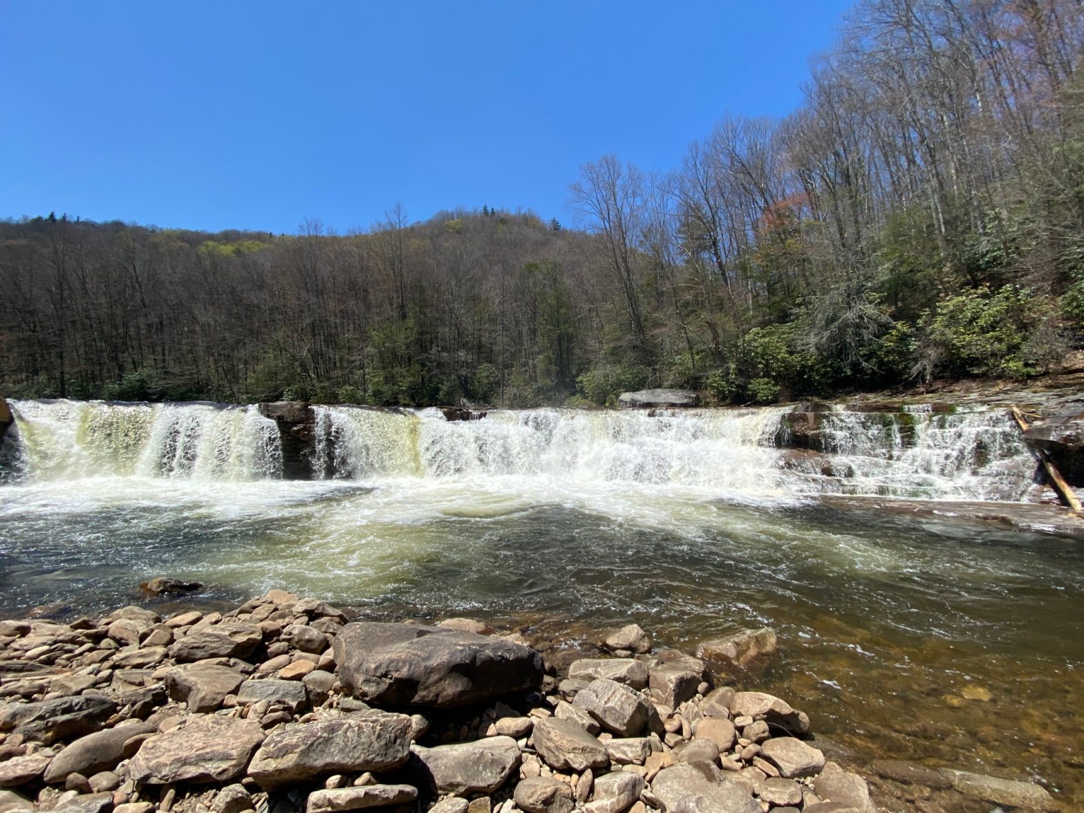
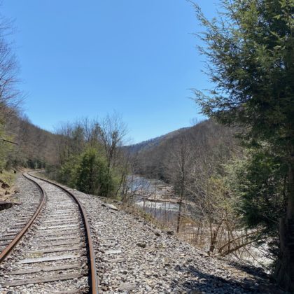
Once you make it to the railroad tracks you’ll take a right to continue following the blue trail markers to guide you the rest of the way to the High Falls of Cheat. There is a trail on the left side of the tracks for the most part, but some of the trail becomes large rocks from the railroad which can be hard on the ankles. It is illegal to walk on the  railroad tracks and the train (New Tygart Flyer) does travel them regularly. It is about a 20-25 minute, one mile hike to the High Falls.
On a lucky day if the train isn’t running, you will have the beautiful falls all to yourself for a nice lunch in the sunshine. If the wind is blowing you’ll even be able to feel the midst coming off of the falls. Take a photo of your adventure to share with us by using #RandolphWV. If you’re bold enough it’s the perfect place to take a dip.
With your feet rested, belly full, and body sun-kissed, it’s time to make your way back over the mountain. Just remember as you are hiking back along the railroad tracks to look for the trail on the left-hand side because it’s quite easy to get lost in your thoughts and miss it.
 All in all it was a beautiful day in the mountains of West Virginia. Sometimes it just takes getting outside and breathing in that fresh air. For a leisurely trip to the High Falls of Cheat you can take a train ride with the Durbin and Greenbrier Valley Railroad. The New Tygart Flyer is a 4-hour round trip to the Falls that leaves Elkins at 11am and returns at 3pm.
Some key takeaways:
— Don’t wear biking shoes on a 12.6 mile hike, be prepared and wear hiking shoes.
— It’s more of a hassle to ride a bike and ditch it somewhere. Seriously… just hike forget the bike.
— Bring a lunch and plenty of water. The view is perfect.
— Always pack a first aid kit for the blisters (unfortunately the bike shoes didn’t treat me well).
— Moderately strenuous hike, and not for the faint of heart.
— Prepare and plan for a full day adventure.