Expansive. Vast. Sweeping. Dense. Wild. Lush.
As an avid mountain biker or hiker, these are the exact words you want to hear from someone when they are describing a place you should adventure to next. There are many parts of Randolph County that are unique to themselves, but this particular place is like none other in the state. Located (off US250 on Forest Road 227) in the southern part of the county on a high, rugged ridge of Cheat Mountain are the Mower Tract Basin Trails.
Part of the Monongahela National Forest, Mower Tract hosts one of the largest red spruce stands south of Maine and also one of the most biodiverse regions in the country. As you travel along the gravel forest service road, you’ll notice incredibly bare portions of the mountains in this area. Here’s a little history lesson to ease your curious mind. In the late 1970s and 1980s, about 2,500 acres of the Mower Tract were strip mined and considered a biological wasteland. In order to protect Mower Tract, the U.S. Forest Service and Trust for Public Land acquired surface rights for the property from the Mower Land and Lumber Company in 1987 and thus began working on the reforestation of this area by restoring red spruce forests, cleaning up watersheds, and bringing recreation opportunities for folks like you to this area. Check out the Highland Outdoors article on additional information about the history of Mower Tract.
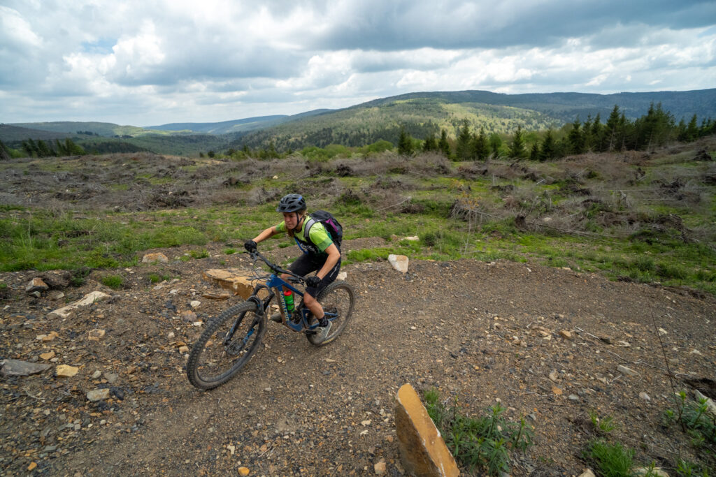
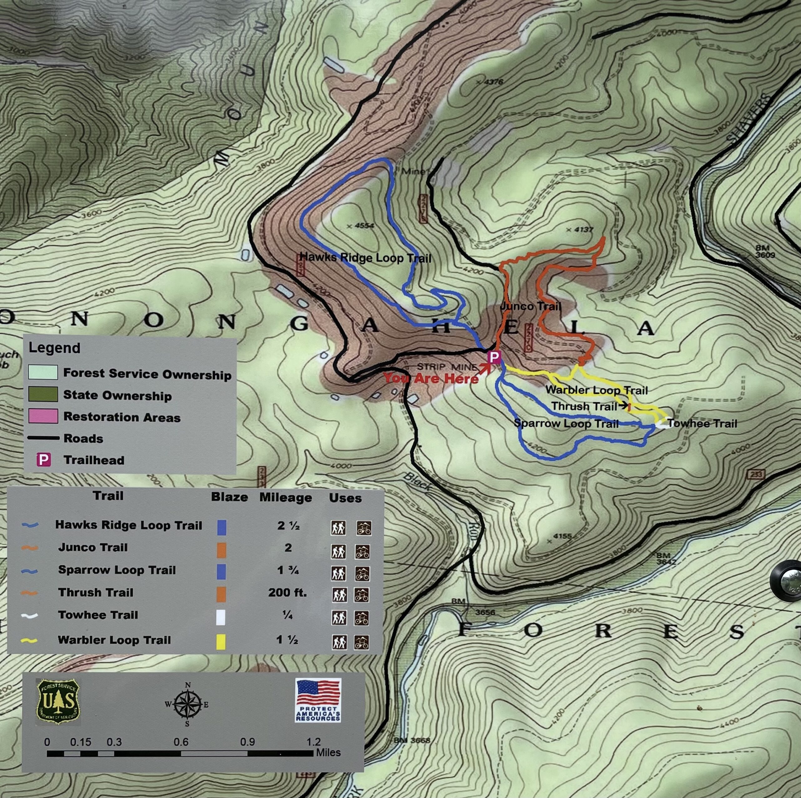
Now, let’s to get to the good stuff. The trails! The Mower Basin Trails are West Virginia’s first, and so far, only, mountain bike destination recognized by International Mountain Bicycling Association (IMBA) for its extensive system of well-designed single-track trails suitable for all skill levels. In addition, they are part of the Snowshoe Highlands Ride Center. With 12 miles of trails and new ones under construction, plus a bike repair station at the trailhead parking lot and dispersed campsites, this adventure spot will keep you coming back for more.
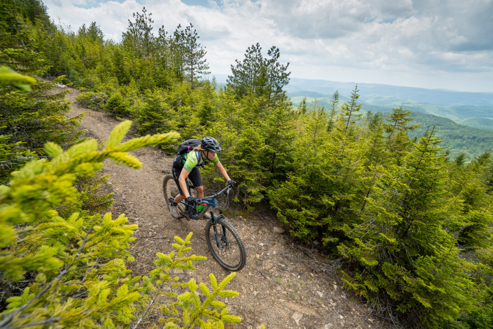
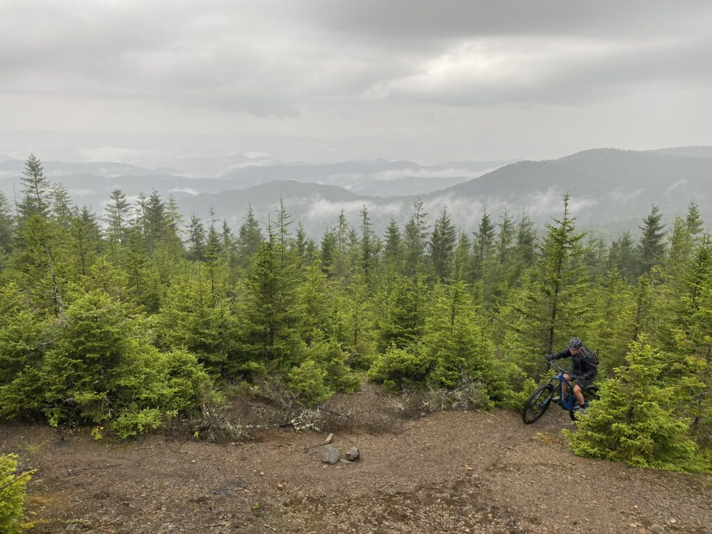
The Hawks Ridge Loop Trail is a 2.5 mile loop that starts off with a significantly steep incline between two old strip mines. Once the trail reaches the top, you’ll bike along a ridge that greets you with spectacular views of the Allegheny Mountains. There will be a continual steady climb until you reach a dense forest on the unmined east slope. Even in the middle of a sunny day, the tightly knitted trees will provide little light as you immerse yourself in the mossy oasis. This part is challenging due to its rock beds, large roots, and narrow openings. Once through the woods, you’ll enter a clearing that will take to a smooth, fun downhill to back your vehicle.
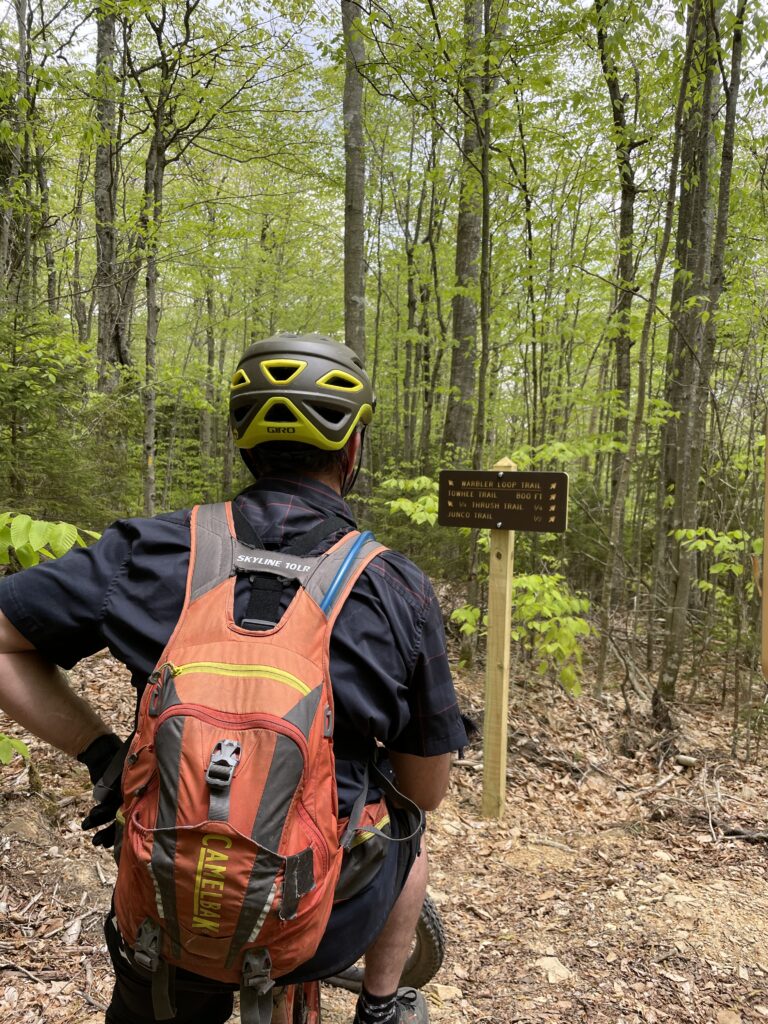
The additional trails, Sparrow Loop, Thrush Trail, Warbler Loop, and Junco Trail, start on the opposite side of the road from Hawks Ridge Loop. Sparrow Loop Trail is a 1.75 mile loop that begins with a slight uphill. This is a really fun, fast-paced loop that you can take at your own pace or challenge yourself to push through it. This trail is shaded by the canopy of Norway Spruce, Beech and Birch trees. The twists and turns of short up and downhill bursts makes your heart start pumping. Because of the shade, the trail stays moist so be prepared for some mud, wet roots, and rock beds especially if it has rained. This is also an ideal loop for cross-country skiing in the winter months as long as you can get there. The road is not plowed so snow tires, chains, and an experienced driver is necessary. You’ll get to an intersection at the bottom of the downhill and you have a few different trail options or continue your loop to make it back to the trailhead.
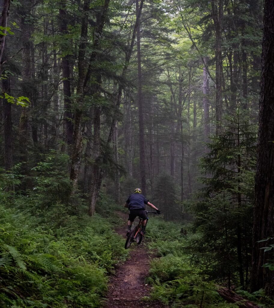
The Warbler Loop Trail is a 1.5 mile loop that takes you on an old logging road overgrown with grass. During the spring and fall, beautiful wildflowers bloom along the trail. This ride is smooth and flowy. You’ll reach an intersection where you can join the Junco Trail or continue the loop. As you continue downhill the trail will switch from grassy to single-track dirt. This trail is one of the easier biking and hiking trails. There is also a “jump” portion off this trail called the Thrush Trail, climbing up it can be very challenging. The decline has some sharp “S” turns that even the fastest riders have to use their breaks. At the end of the decline, you’ll come to another intersection where you can extend the loop by a quarter of a mile and ride the Towhee Trail. Again, you have more options: to either climb back up the Warbler Loop Trail to complete it or try your hand at the Sparrow Loop Trail describe above.
Now onto the Junco Trail which is 2 miles. It is our preference to ride the Warbler Loop Trail to connect with the Junco Trail. In our opinion, this way seems to be the better ride, but you can also start this trail on the road and the start of it is a steady, long thrilling downhill run. Either way you ride it, you’re bound to see some wildlife and truly experience the variant landscape. If you go our way, you’ll have both tricky uphill climbs and fast downhill runs. In the beginning you’ll go through spruce tree stands and in between large rock formations. The trail itself is hardpacked dirt and gravel. On your ride, you’ll also see scattered vernal ponds that have been created by the USFS, which help control sediment and provide habitat for amphibians. In some portions, you’ll almost feel as though you are in a different world due to the bare, rocky scenery from old strip-mining techniques and current prescribed burns.
To say the least, a visit to Mower Tract should be your next mountain bike destination. It’s a living laboratory that reveals how detrimental the past can be, but also illustrates the hopefulness for the future. It’s an eye-opening, wild experience that everyone should see, and what better way than on two wheels. For more information and other places to explore in the Cheat Mountain area, click here.