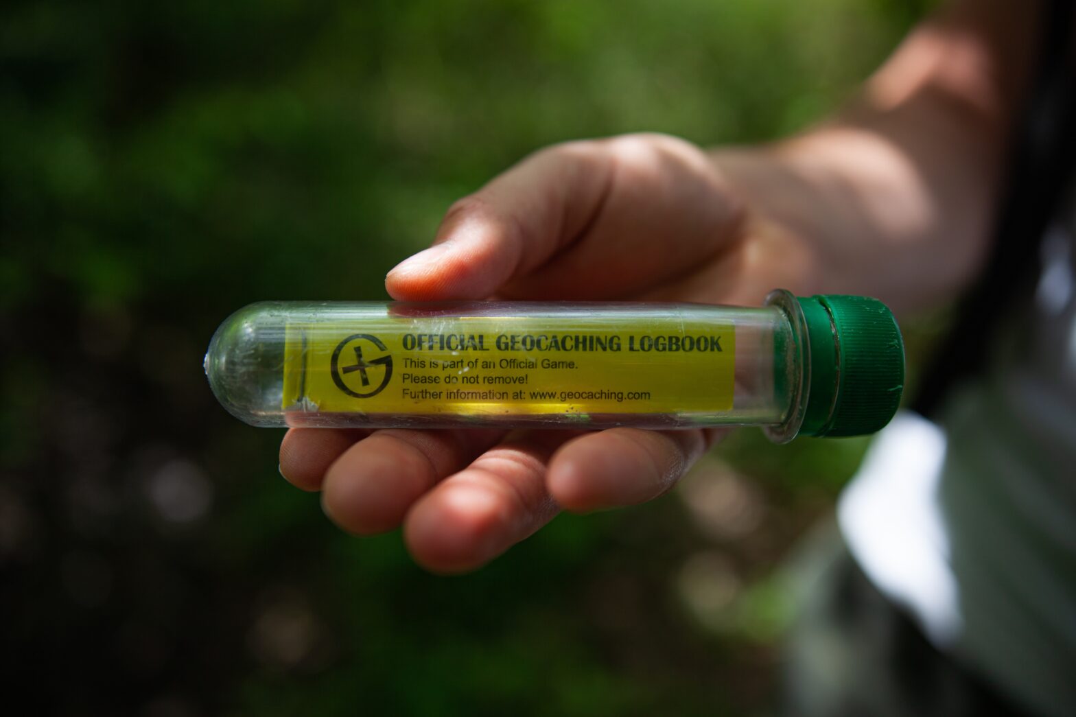
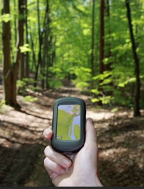
 Treasure in West Virginia is all about finding treasure through adventure. Geocaching is a modern-day treasure hunt for the whole family. It involves using a handheld GPS or smartphone to find small containers, often full of prizes, hidden by other players. Each container is generally waterproof, some contain small items, and each contains paper, to sign your name and prove you’ve been there. The best thing about geocaching is it’s a family-friendly free activity and you never know what you might find! You can start your geohunt by downloading the geocaching app or visiting geocaching.com.
First things first; let’s go over the rules. If you take something from a cache, always replace it with something else and be sure to leave no trace, follow established trails, and respect your surroundings. Remember that anyone can find a cache so only hide appropriate items. Also, each geocache has a terrain of one to five stars. One star means the geocache is accessible by wheelchair, and five stars means you will need special equipment (boat, 4WD, etc.) to find the catch. The difficulty level is similar, one star means the cache can be found quickly, where five stars means the cache is hard to find.
Randolph County is full of caches. To browse them all, go to geocaching.com. Each cache is usually close to others, so you might be able to find several in the area. Here are a few interesting geocaches in Randolph County.
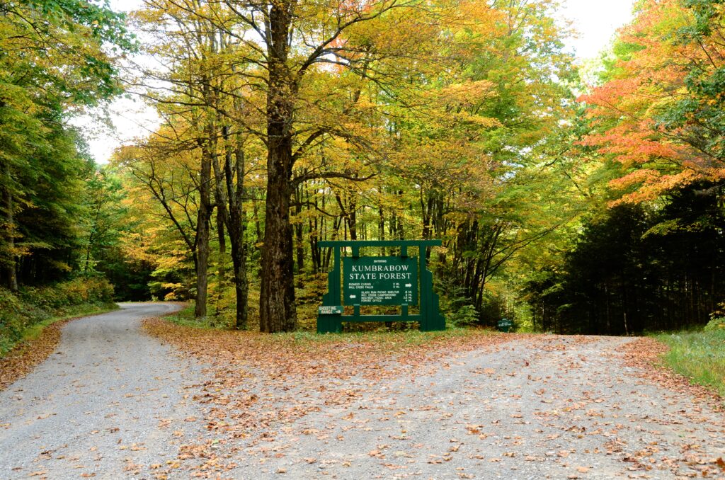
Kumbrabow State Forest: This is a small cache located in Kumbrabow State Forest, the highest state forest in West Virginia. The cache is made of PVC pipe and has room for small items. It is located just off of the Whitman Trail. Kumbrabow State Forest is open to the public from 6:00 a.m. to 10:00 p.m., unless registered as an overnight guest. Also, due to the forests high elevation, this forest is remote and snow is common anytime between October-April. All roads in the forest are gravel/dirt and are well maintained. However, 4wd or AWD “might” be necessary during these months. Coordinates are as follows: N 38 37.360 W 080 07.045
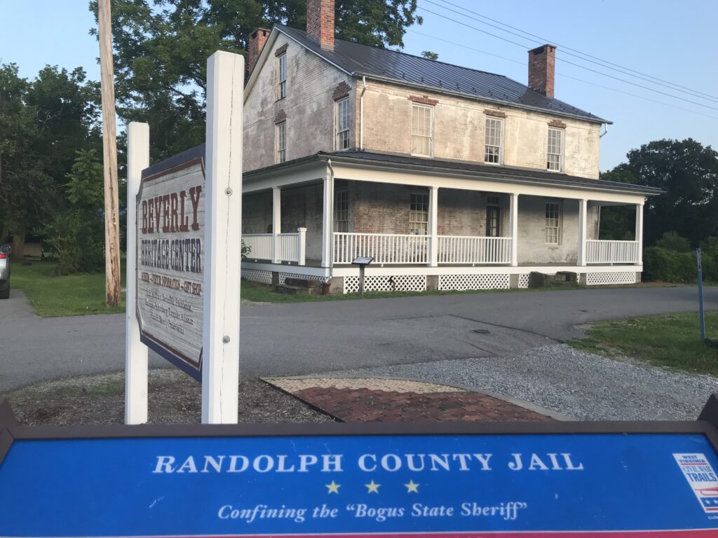 The Randolph County Jail of 1841: This cache is located in historic Beverly at the 1841 Randolph County Jail. The jail is located behind the Beverly Heritage Center on Walnut Street. Find this roughly six inch square and one inch deep container near the 1841 jailhouse porch. One can park at the Beverly Heritage Center and commence your search. While there, stop in the Beverly Heritage Center and learn about the story of the Battle of Rich Mountain Battlefield and the First Campaign of the American Civil War, the pivotal role of the Staunton-Parkersburg Turnpike, and daily life in a small rural county seat through the 19th century. Coordinates are as follows: N 38 50.415 W 079 52.492
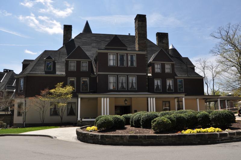 Graceland and Halliehurst Mansions: The haunted cache. Nestled on the campus of Davis & Elkins College sits two mansions that are now used as an administrative building and inn for the school. Countless stories from students and staff report that poltergeist activity is common in these buildings, such as doors closing by themselves or guests feeling an invisible hand touch them. Abstract figures are also seen from the windows of both mansions, as if yearning to escape into the outside world. Please use etiquette and be courteous when geocaching on campus and place the container exactly where you found it. Coordinates are as follows: N 38 55.880 W 079 50.826
 Fox Forest Wildlife Management Area: The Fox Forest WMA is a wonderful place to hike near downtown Elkins. It consists of 122 acres of land that is forested and includes hills, streams, a pond, and an overlook of the city. There are a total of 9 trails. This cache is a short hike from the Division of Natural Resources parking lot near the pond. Although it might be enticing to jump in the pond, we can assure you it is close to the water, but you don’t have to get in. You can also park at the Scott’s Ford Fishing Pier for a longer hike. Coordinates are as follows: N 38 54.009 W 079 51.545
Allegheny Highlands Trail: The Allegheny Highlands is a level, wide, rail trail for biking, hiking, horseback riding, and cross-country skiing. There are several caches along this trail, one specifically designated for children. The clear ammo can blends in the wooded spot free of poison ivy, nettles, and thorns. See how many more you can find along the trail. Coordinates are as follows: N 39 02.692 W 079 49.034
Stuart Recreation Area: This cache takes you near the Stuart Recreation Area in Bowden. It’s about a 10 minute drive from downtown Elkins. What’s fascinating about this cache, is it is near a natural spring at the entrance of Stuart Recreation Area. It’s a medium sized cache that blends in well with its surroundings. Any place where cold, clean water rises from the earth is special. Finding this cache will take you on a short walk through the woods behind the spring. As a celebration of your find, we encourage you to have a drink of the refreshing mountain water. Coordinates are as follows: N 38 54.968 W 079 46.129
From city parks, roadside pull offs, and well-known attractions to clues, coordinates, and family-fun, the best thing about geocaching is that it gets you outside exploring the world. It’s a game of adventure and discovery. So what are you waiting for?